
The last canal house
As we headed up the first miles of the Great Allegheny Passage (GAP) yesterday afternoon after the deluge led to changed plans, we immediately missed the Potomac River ceaselessly flowing to our left and the canal carved into earth to our right. For days we travelled with these stunning features astride us, and then they were gone. We moved on into the Cumberland Narrows and started heading up toward the Eastern Continental Divide in the Allegheny Mountains. Gone were the locks, enduring ghosts of the C&O Canal’s heyday, and the towpaths, heavily stepped upon by many decades worth of indentured mules. Hours and hours of greenery and woods would suddenly be broken by a splash of white as we came upon a canal house. We missed the way the river and the canal and the locks wrapped us and carried us along in a new sense of time that we settled into pretty quickly after we left Washington D.C. and slipped into the Potomac lowland wilds of western Maryland.

The Start
This morning, however, we got to revisit the C&O Canal and the Potomac one more time as we filled the gap that the deluge had created. Yesterday we left the trail at Lock 70, Mile 166 in the interest of sparing my wheelchair from likely water damage in the many puddles that the grey clouds left behind. Yesterday afternoon we picked up the GAP at Mile 0 (which is also the end of the C&O Canal Trail, Mile 184.5) and headed northwest from there. So we had about 18.5 miles to fill in order to complete the C&O Canal Trail, and we set out to do that in reverse direction this morning starting at the end. So the canal was to our left, and the Potomac to our right as we headed southeast toward Mile 166. We were all motivated to finish the C&O, but we didn’t know what trail conditions we’d encounter.
My morning pep talk at the confluence of the C&O Canal Trail and the GAP once again led to a Dr. B and Jimmy chest bump. I guess that I’m a rousing speaker. Dr. B absorbed the impact a little bit better this morning. Those clowns are now rocking new checkered skate helmets in what seems to me to be an unflagging effort on their parts to look ridiculous.
Canal Boat
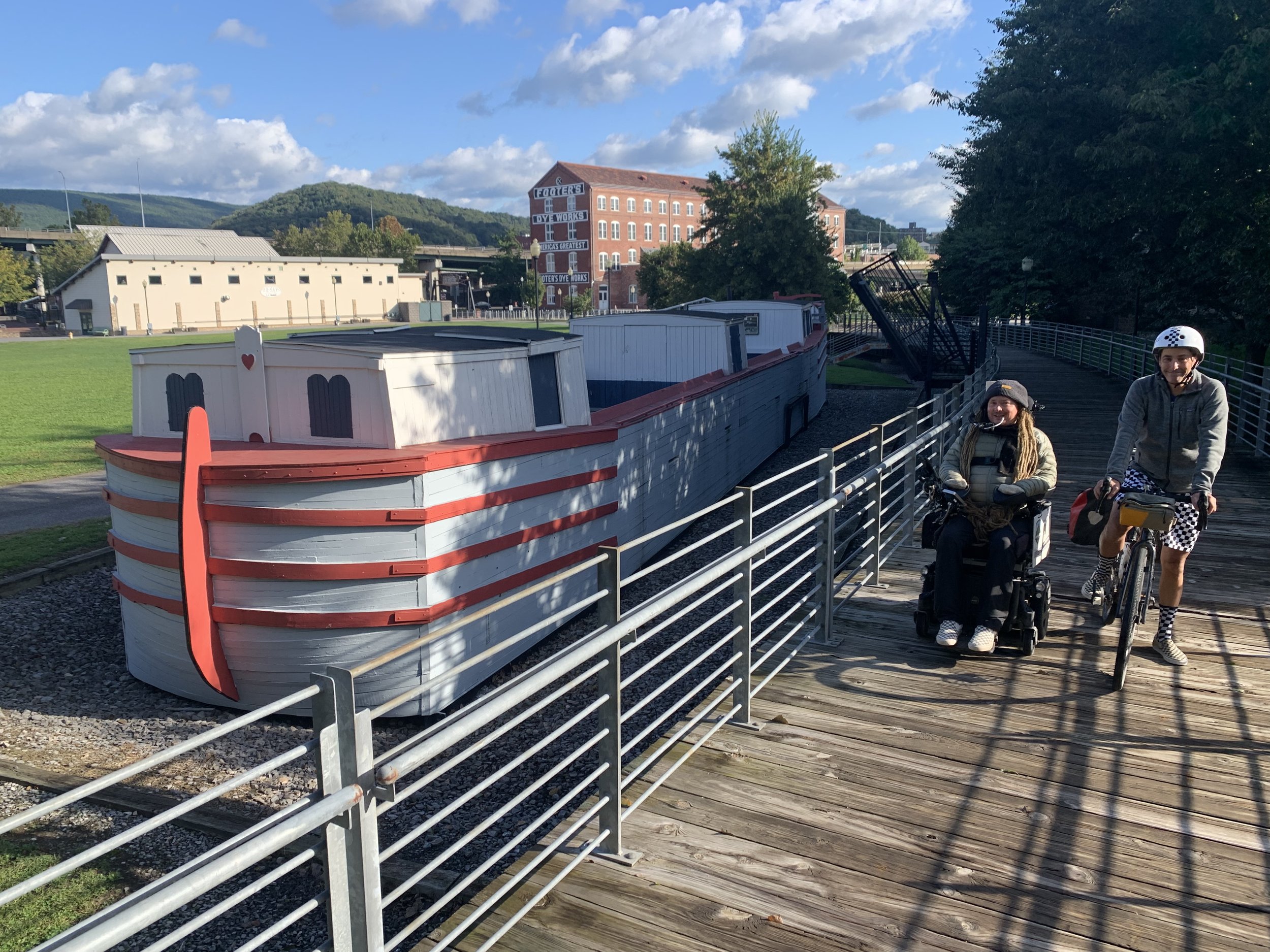
At the end of the C&O Canal Trail there is a restored canal boat called The Cumberland. Dr. B, Jimmy and I stopped and pondered the boat for a little while, each of us impressed with its size given that these boats- filled with coal or wood or other goods- would be pulled by mules over great distances. We could envision the boat sliding into one of the many locks that we’ve passed, and could imagine the lock doors in operation, raising and lowering water levels.
The Epitome of Style

Slightly muddy C&O
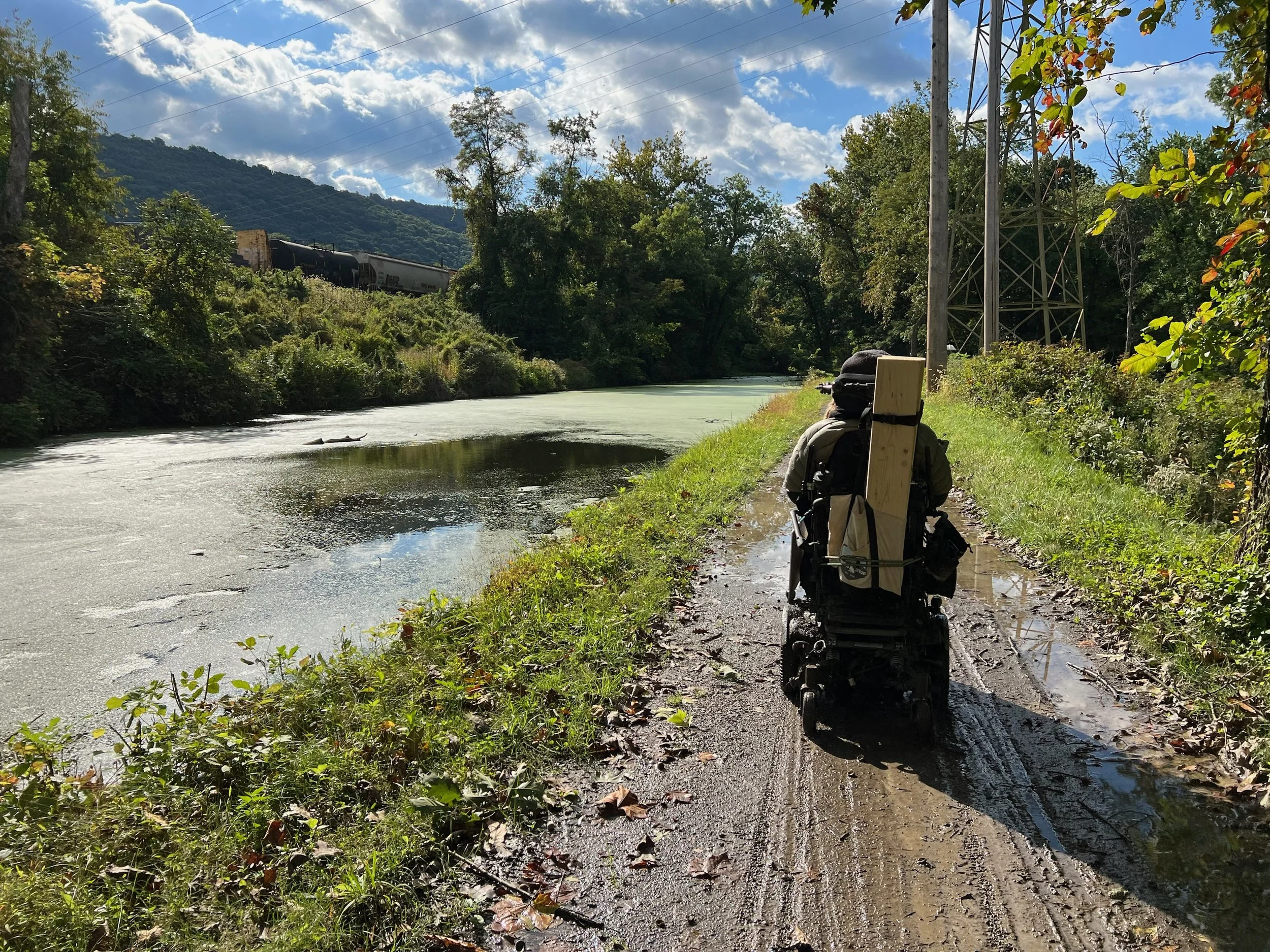
Fortunately, a lot of the water on the trail had receded in the 17 or so hours since the heavy rainfall, and we were able to roll forward. Or should I say backward. Sometimes we’ve got to to go backward to move forward. As much as puddles had receded, there was still a lot of water on the trails, and a lot of mud. I had to weave and veer and maneuver through and around mud and water of unknown depths. Dr. B and Jimmy had to do the same. When I had to go through water, I’d slow down a lot, which minimized splashing and reduced the risk of water reaching my motor controller, one of the parts of my chair most susceptible to water damage. The lower part of my chair got shit show dirty again. Mud compacted between Jimmy’s rear wheel and his rear fender, and he had to clear that all out a few times as we made our way along. There was a team of cyclists that we leapfrogged a bit, and at one point when they were ahead of us they stopped to clear a small downed tree with me in mind. They were just finishing up as we came up and we all expressed our gratitude for their efforts. This was another example of the help that we’ve gotten from all kinds of people along the way.
Mt Savage Tunnel
Again!

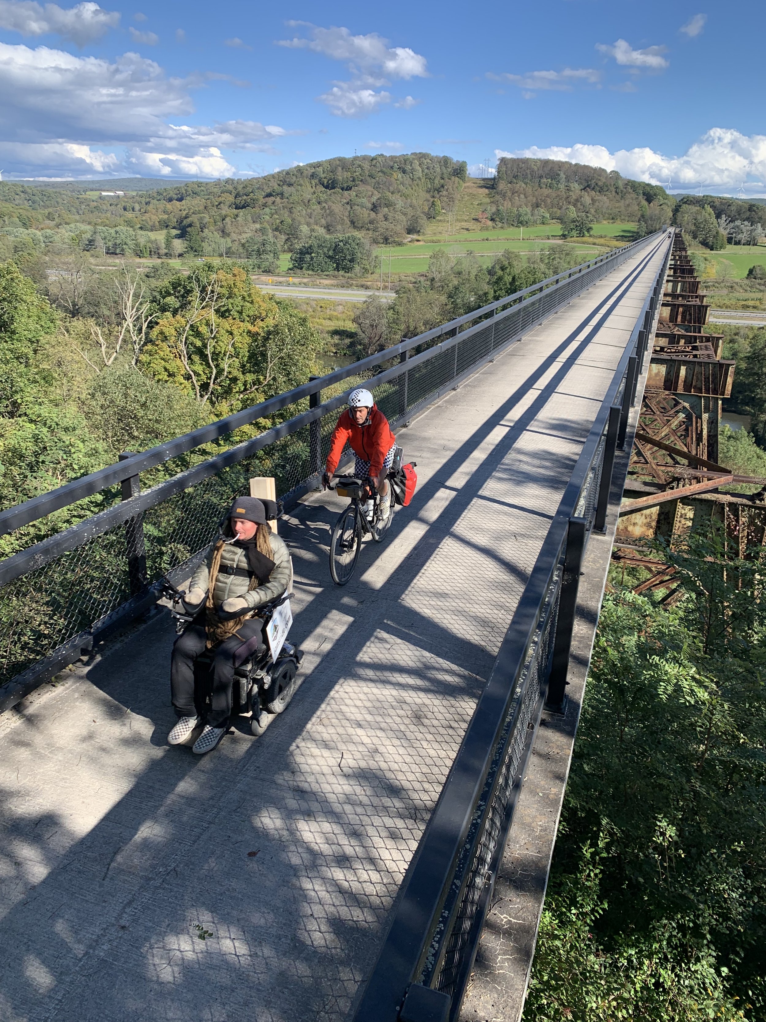
The Salisbury Viaduct
After a lot of maneuvering, we came upon Lock 70 and its canal house, and we rejoiced in completing the 184.5 mile long C&O Canal Trail. We couldn’t celebrate for too long, however, as we needed to get back to Frostburg, where we had ended the day yesterday on the the GAP. So we bid the Potomac River and the canal one final adieu, cleaned up my chair and the crew’s bikes as best we could, loaded up into the Minivan and headed to our starting point on the GAP.
From Frostburg we continued up slope on the GAP toward the Eastern Continental Divide. From Mile 0 (which, again, is at the end of the C&O Canal Trail), the GAP has been smooth and completely accessible. After all of the puddles and rocks and steep detours and makeshift ramps and overheating motors of the last few days, the GAP felt so smooth it was almost boring. Due to all the hardships of the last few days my confidence in my chair was shaky. However, by the end of the day today my confidence in my chair was fully restored. For all I’ve put it through lately, it performed like a champ much to my gratitude and relief!
The Mason Dixon Line
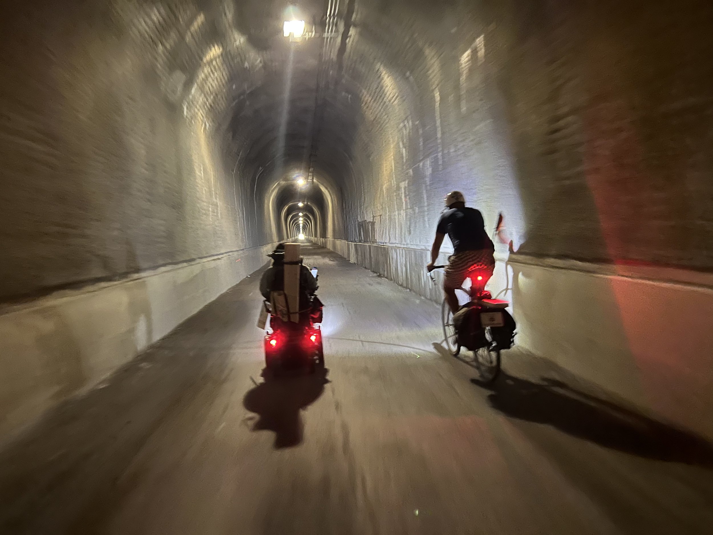
The GAP is a beautifully maintained trail that goes through gorgeous country. 20 minutes after going through the Borden Tunnel (we went through a number of tunnels and over a number of bridges, only some of which I’ll call out now) that was built in 1911, we arrived at the Mason-Dixon Line and therefore crossed into the state of Pennsylvania. Not long after that we went through the 0.62 mile long Savage Tunnel, and it was cold in there. Shortly after that, we crossed the Eastern Continental Divide, which separates watersheds that flow into the Atlantic to the east from watersheds to the west that ultimately flow into the Gulf of Mexico. At 2,392 feet, I believe that this will be the highest point of our whole trip. The fall foliage again stepped up a notch, now with more splashes of orange and red among the yellowing leaves. From the Divide, it was a gradual descent to the day’s finish point in Rockwood, Pennsylvania. We went over a number of bridges, some short like the Bollman Bridge, an 1871 iron railroad bridge that was moved in 2006 to serve as a bridge for the GAP; and some long like the Salisbury Viaduct, a trestle bridge that spans almost 2000 feet. This bridge was built in 1912 to hold 2 tracks. Only one track was ever built on it. It was decommissioned in 1975, and fortunately it became part of the GAP in 1998.

These bridges and others from this afternoon spanned Casselman River, which we found ourselves riding along at the end of the day. We enjoyed the brisk fall air and were thankful for another beautiful day along two sections of this mind-blowing rails to trails system.
We finished in Rockwood for the day, and after our celebratory photo, we had the pleasure to be joined by Barb Zablotney. It was nice to meet her and visit for a while.

Proud Partner of